Inspiration
AccessMap was inspired by seeing people experiencing homelessness struggle to find basic facilities like public restrooms and shelters. We realized this data gap affects many groups, including parents, older adults, travelers, and people with disabilities. That is the curb cut effect: when you design for the most vulnerable, everyone benefits.
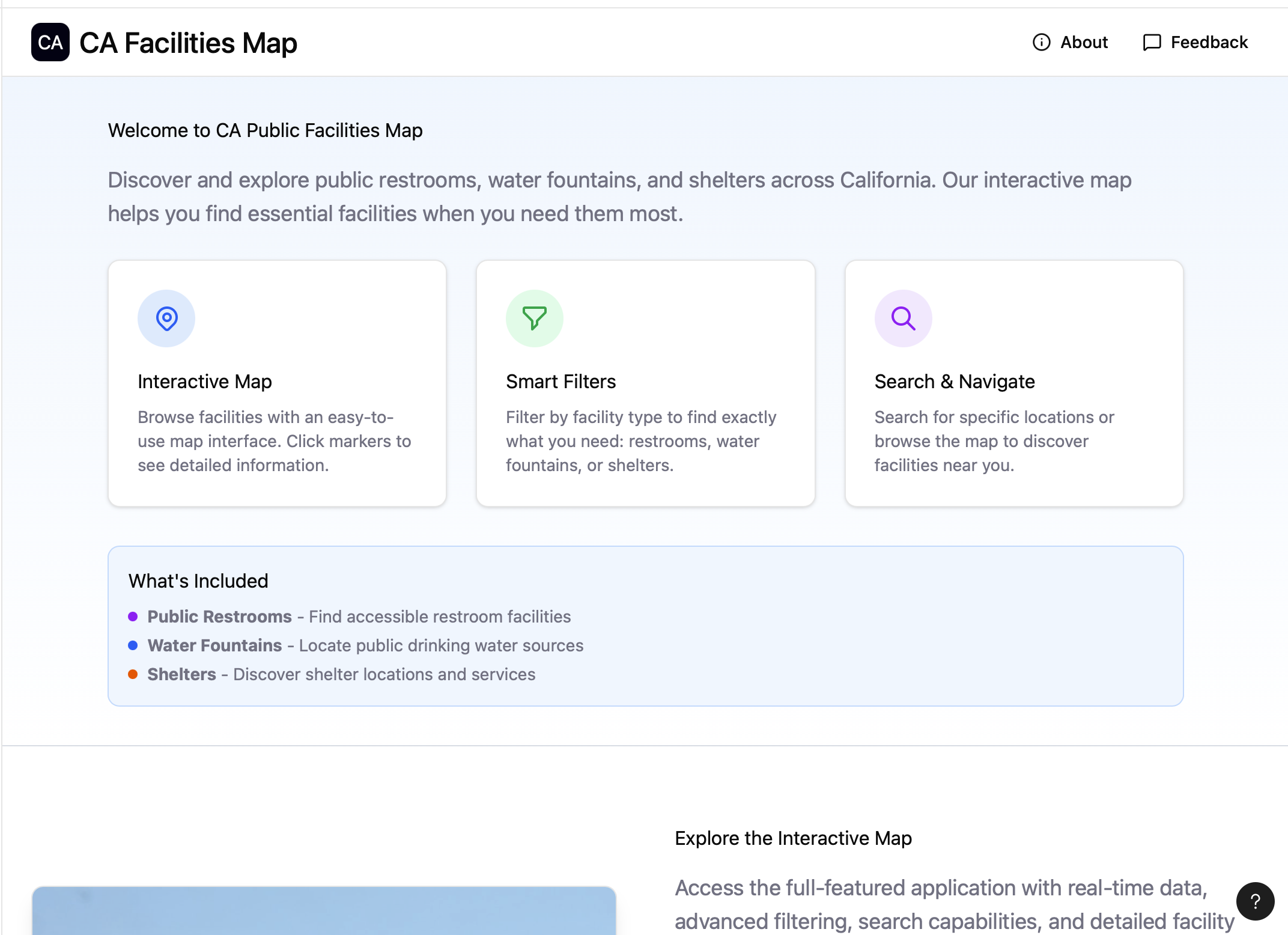
What it does
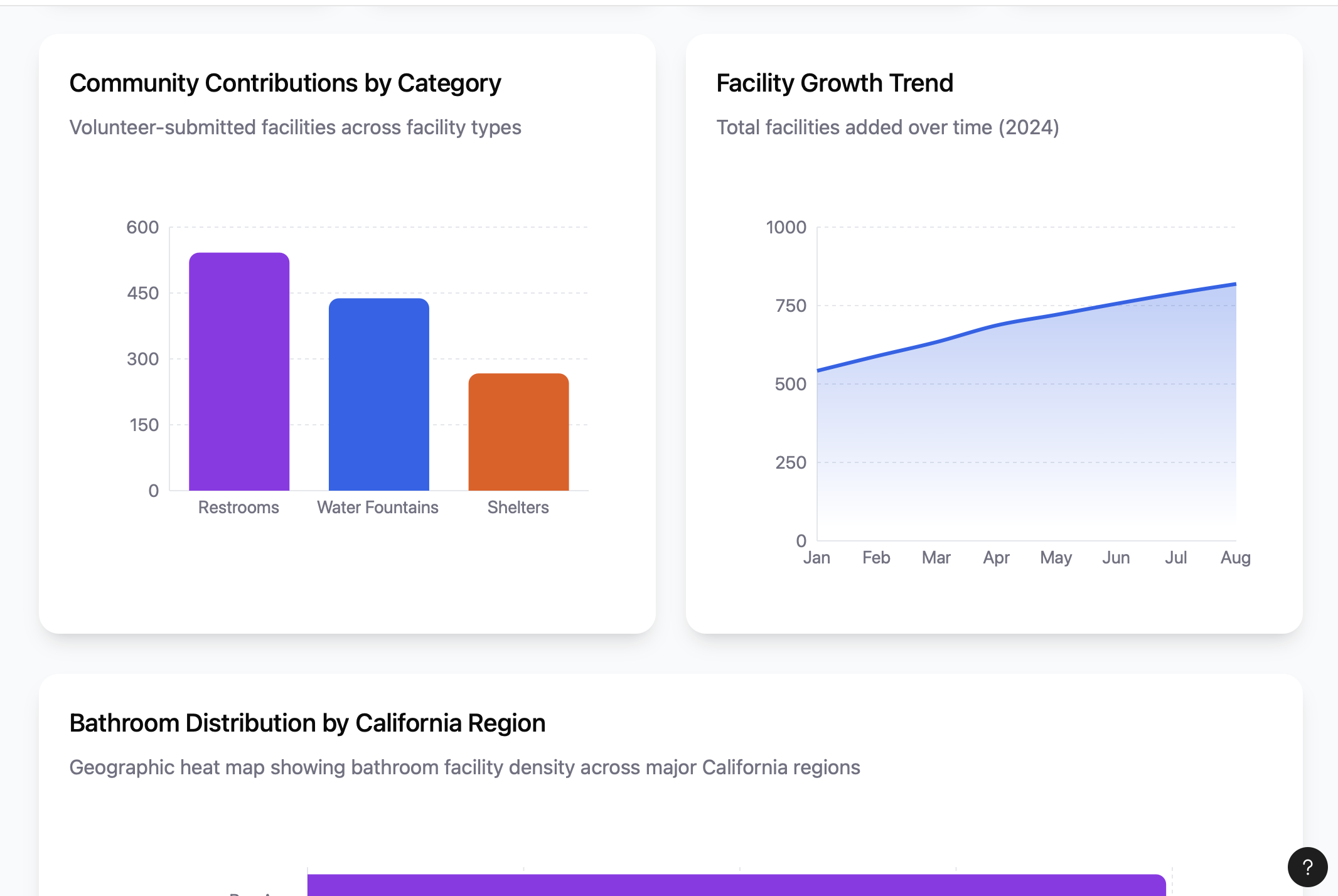
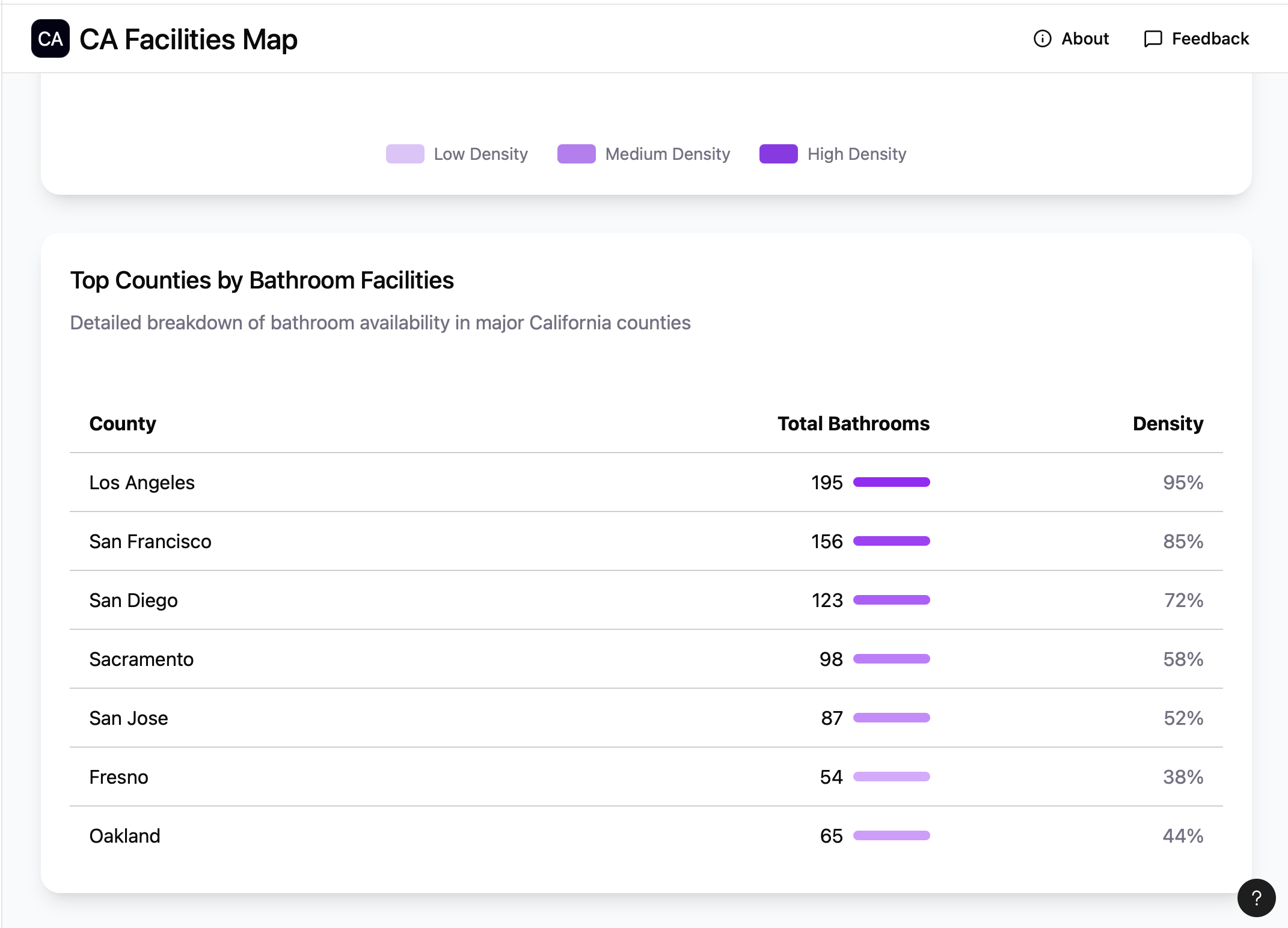
AccessMap displays nearby public restrooms, water fountains, and shelters on an interactive map, allows simple filtering for key attributes like wheelchair access and hours, and highlights neighborhoods with limited access so users can plan quickly and communities can spot facility deserts. It also supports crowdsourcing so anyone can add a new location, correct details, and record attributes such as cleanliness or amenities, which keeps the map current and useful.
How we built it
We built AccessMap on Next.js and used the Model Context Protocol to coordinate two data services. For public facility information, we used a Google Maps MCP for discovery and visualization. For privately owned but publicly accessible locations, we combined Bright Data’s web scraping tool with previously collected datasets.
Challenges we ran into
The hardest problem was fragmented and incomplete data. Many cities publish different schemas or none at all, business data shifts often, and duplicate entries were common. We addressed this by normalizing fields into a consistent schema, adding validation checks, building duplicate detection, and using Bright Data to gather information where open data was missing, which together improved coverage and accuracy.
Accomplishments that we're proud of
We delivered an MCP-driven pipeline that unifies public, private, and user-submitted data into a single source of truth, a responsive map that scales to large datasets, and a transparent contribution flow with review history and automated checks. Most importantly, we produced equity insights that make it easier to identify underserved areas and user engagement.
What we learned
We learned that schema design and validation are just as important as connectors, that low-friction crowdsourcing can close data gaps quickly, and that clear input and output contracts for MCP services reduce errors and keep ingestion stable. Continuous monitoring and lightweight checks at submission time saved significant rework later.
What's next for AccessMap
Next, we will expand city coverage, increase refresh frequency with scheduled MCP runs, and add attributes that users request most, including gender-neutral restrooms and baby-care amenities. We plan to partner with advocacy groups and agencies for trusted verification, open a public API for researchers and civic projects, add user alerts for changes in selected areas, and explore accessibility-aware routing that factors in sidewalk conditions and curb cuts.
Built With
- brightdata
- figma
- google-maps
- mcp
- python
- vercel
- windsurf


Log in or sign up for Devpost to join the conversation.