-
trip traffic data
Inspiration
The world is a busy place, and we need safer transportation for everyone, and a way to incentivise better driving, and generally being a better planner.
What it does
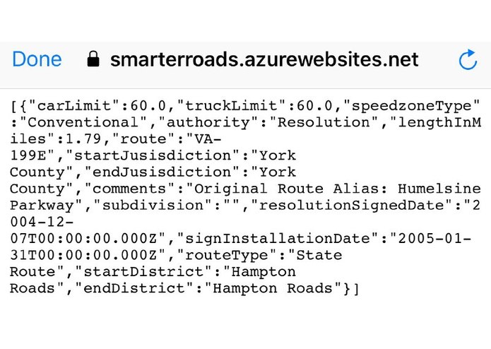
Cross-discipline, no one has built a lat/long lookup for speed limit. Can be integrated with address geocoders to allow more efficient processing of ticket citations, GPS apps, and more. Limitless potential. Incorporate end-user feedback: The robust web API interface allows for anyone to consume the system and query by lat / long or grab whole feature lists.
How I built it
Uses the latest .NET Core v2.1 release which works across Windows, Linux, and Mac environments. Can be deployed to the cloud or run on any device that has enough memory to load the shapefiles (if run in memory locally) or able to connect to a SQL server backend.
Challenges I ran into
parsing the shapefiles, to geometry
Accomplishments that I'm proud of
the teamwork involved, and collab
What I learned
This isnt easy, the data provided needs to be properly formatted, or can be provided in a easier to use format
What's next for A Visible Journey
Microservice able to be run on any device (cross-platform) whether locally or in the cloud, datastore in memory on backed by SQL Server. Feasibility to partner: Can work out of the box right now today, just call the JSON api and you're set to go. High success: Accuracy is as precise as the geometry of the shape files provided by the government.


Log in or sign up for Devpost to join the conversation.