-
-
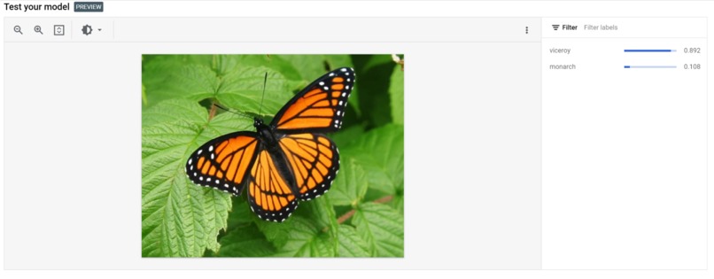
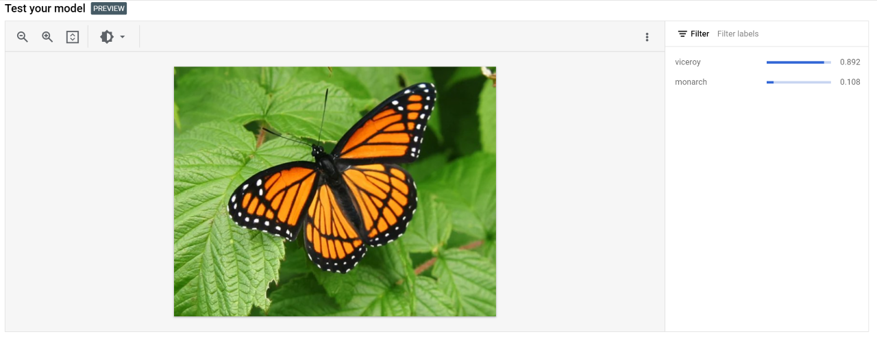
ML classification of viceroy butterfly
-

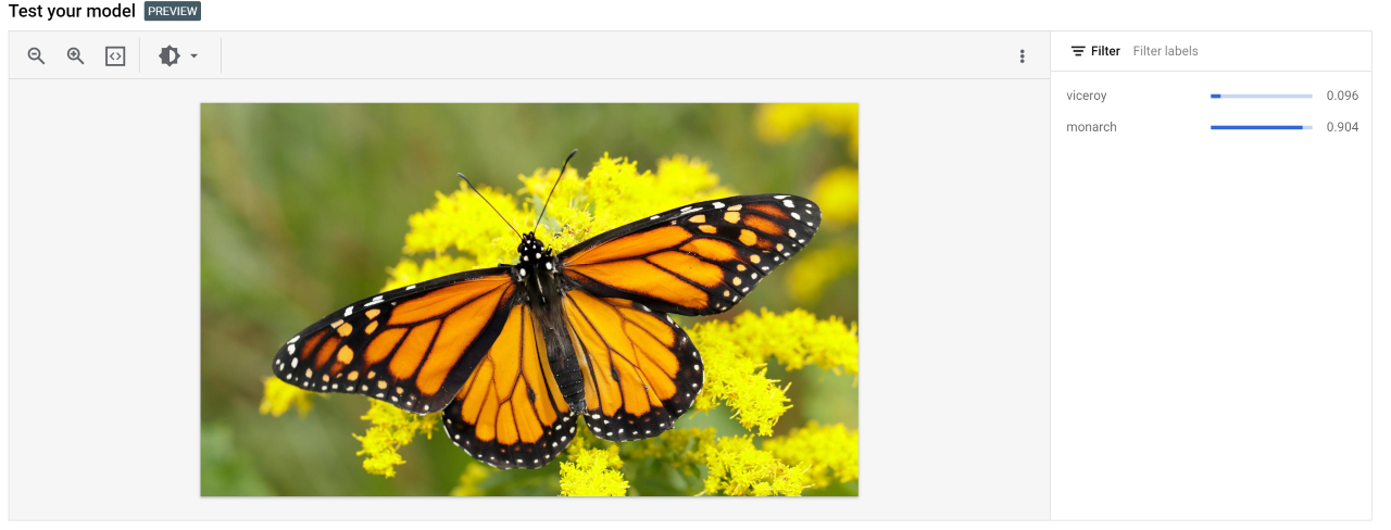
ML classification of monarch butterfly
Inspiration
Monarch butterflies were an endangered species in the world until very recently and are a widely known symbol of conservation. Continuing to protect these insects is essential for sustaining the ecosystems of North America due to their contribution to pollination. According to the USDA, awareness of the butterfly’s life cycle and habitat requirement is essential to their conservation. Many organizations are actively working to preserve the Monarch butterfly. A majority of them utilize citizen science to track these butterflies. Currently, citizens submit sighting reports of tagged monarchs throughout the year to databases such as MonarchNet and MonarchWatch. This established activity in citizen science confirms that our product would be one of interest to the general population of North America, especially on the East Coast. However, this reporting method can be inconsistent due to misidentification of mimic butterflies (such as the Viceroy) as monarchs. Our goal is to create a submission method and database which verified monarch identity. This is also superior to the number tracking method because it allows for a much larger number of verified sighting submissions and therefore more location data. This geotagged data is used to track the Monarch migration path timing and changes and compared against historical temperature data.
What it does
Our project utilizes Web Scraping, Data Processing, and Mapping via Python, an interactive Website constructed with Wix, and a Google Cloud AutoML Image Classification Model to aggregate and analyze citizen science data related to Monarch butterfly sightings and verify each Monarch butterfly sighting via Machine Learning.
Data Processing
The temperature data set was sourced from the NOAA climate data set and categorized by date to be fit for visualization. The monarch sighting data was sourced from JourneyNorth.org by scraping the website with the python library Beautiful Soup.
Mapping
Using Pandas dataframes, the monarch sighting and temperature data were categorized from 1997-2023. The data were plotted on a map of the US and can be found on the website demo described below.
Website
The website was created through Wix. Its purpose is to provide users an efficient way to identify the Monarch butterfly as well as providing their location data. Location data is extracted and stored in a Collection (stored in Content Manager) through Velo by Wix. This collection can be exported as a CSV file, which is the same file type inputted for the data processing. Therefore, this would help easily move data between these two platforms in the future.
Next Steps
Next steps of this project mainly consist of creating a prediction model for the location of Monarch butterflies based on temperature forecasting. This will help further increase knowledge of Monarch migration pattern changes, which can allow for specific areas of interest for milkweed plantation in order to sustain the species. The next main step would be integrating the ML Classification Model into our Wix website. Another next step could be implementing this classification and tracking process for other at-risk species that could be preserved through migration tracking, or even identifying invasive species.


Log in or sign up for Devpost to join the conversation.