-
-
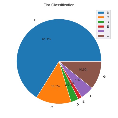
Fire Classification
-
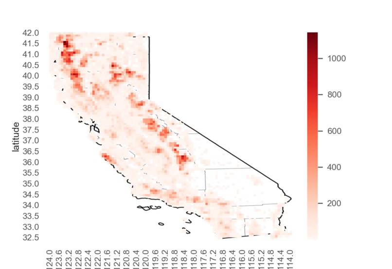
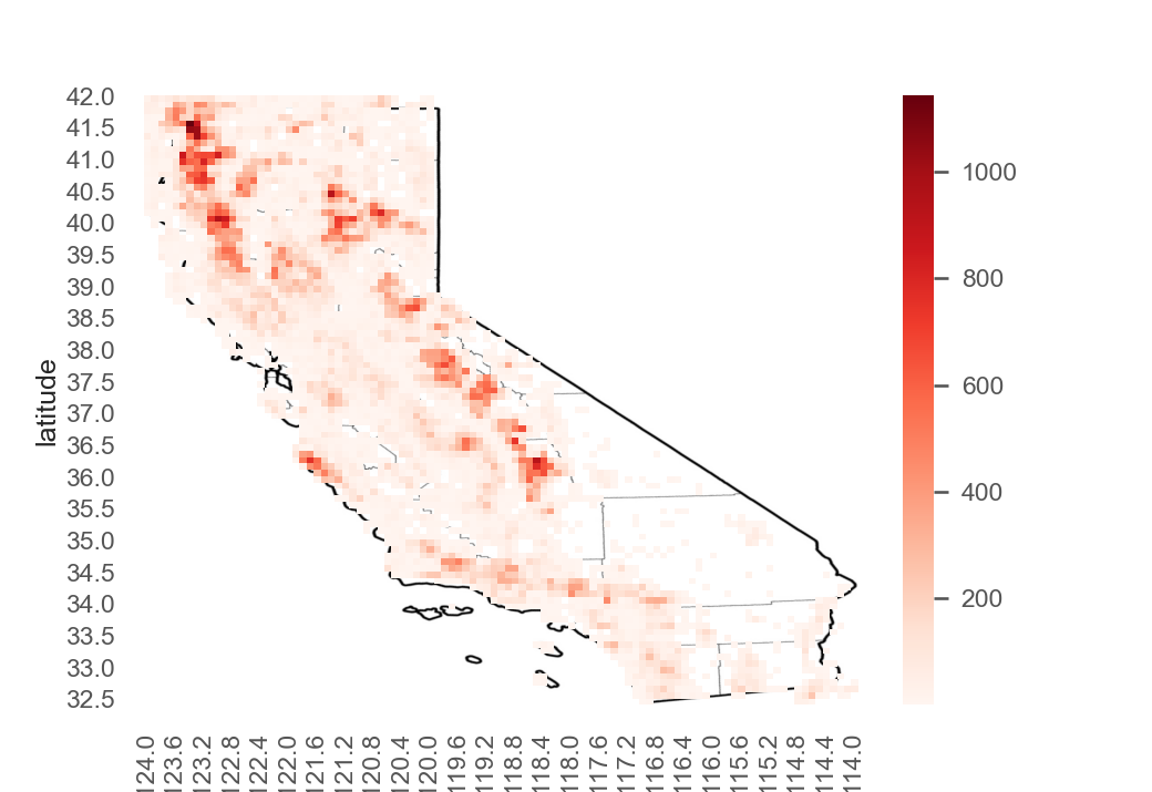
Density of Wildfires in California
-
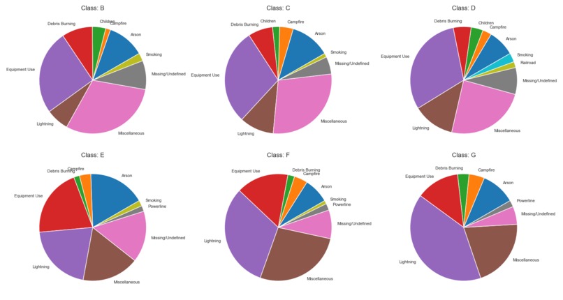
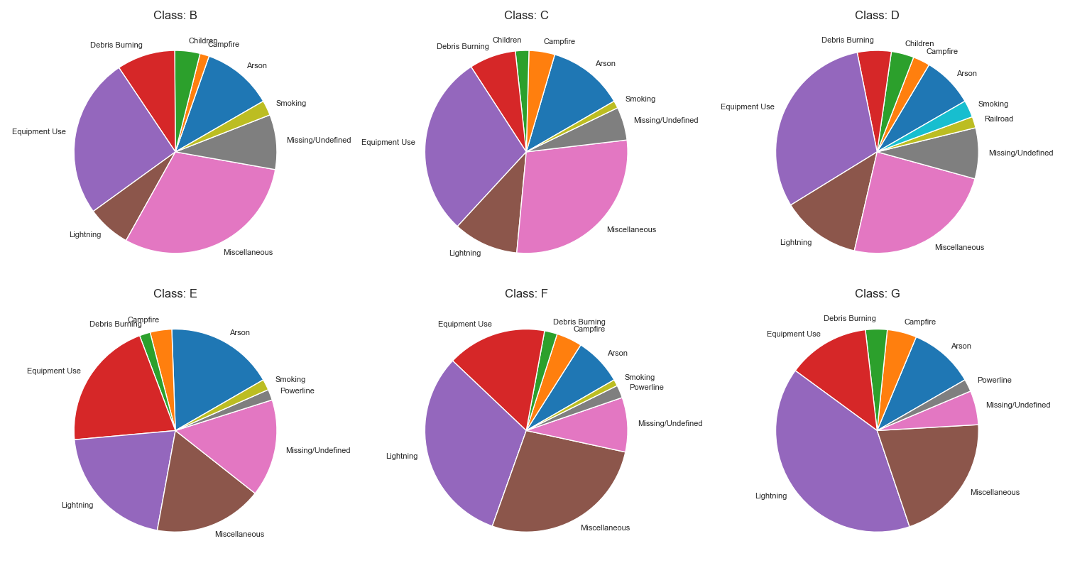
Fire Classes
Inspiration
We wanted our project to be grounded in a real world problem. Having seen the increased frequency in which wildfires appear in the news, and the impact they have both environmentally and economically, we thought this would make for an interesting project!
What it does
Our project uses machine learning to classify areas that are at risk of wildfires, and also predicting how large these wildfires could grow. We also performed exploratory data analysis and made visualisations to better convey our results
How we built it
We built our solution using the IBM-Z platform. All of our code is written in python or MySQL. Various machine learning and imaging libraries were used.
Challenges we ran into
One major challenge we ran into was our linux server shutting down for an hour or so after lunch, which forcced us to code locally whilst simultaneously figuring out a way to get it back online. Another was building our own comprehensive dataset from multiple smaller datasets from various sources.
Accomplishments that we're proud of
-Building our own comprehensive dataset -Solving the linux server crashing problem -Increasing a models performance by 13% by downsampling a dataset and using dropout
What we learned
-Familiarity with combing data -More exposure with Pandas, Numpy and Machine learning libraries -Time management
What's next for 404 not found -IM38
A good nights sleep 😴
Built With
- ibm-z
- jupyter
- notebook
- python


Log in or sign up for Devpost to join the conversation.