-
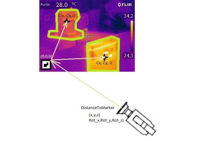
Location for interest area
-
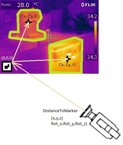
First Proto App to detect/locate codes
-
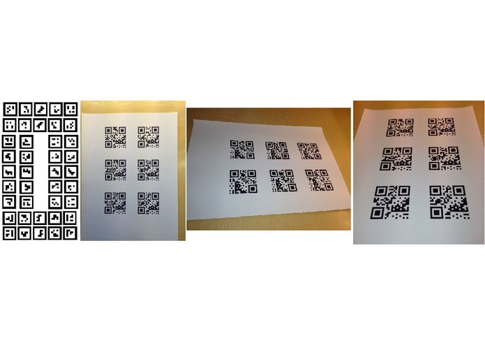
First real codes to evaluate app detect/locate area reliability
Today, with IR techs, on most processes, we have several snapshots along time for one specific evaluation.
For each evaluation we have most important parameters to take this snapshot. Examples are material emisivity, distance, position and angle to take the snapshot, area of interest in evaluation…
The key concept of this proposal is to make first app and backend prototype for associate/adapt snapshot parameters at each evaluation, manage efficiently, and share evaluations to stakeholders with integrity and privacy.
Perceived Effectiveness
At first snapshot of evaluation you would associate a Client, Site, Area, Zone, and one free Aruco Marker into Zone. Parameters would be stored on app directly from IR camera API, or implicitly in regard of marker size and position
Following snapshots of this evaluation, consists in activate normal camera, that identifies code, combinated with Zone(geoloc, beacons, or previously set with camera or selection box in app), adjusts best position and parameters.
User adjust position and parameters if was required, and take this new snapshot.
After this, pre-processing can be set (interest area, …)
On office or connected, snapshots and new parameters/change parameters are propagated to cloud and added to ledger.
Evaluation stakeholders can access to part of the information allowed by their identity, and create/append new knowledge about this evaluation (report info, aggregated evolution, diagnostic,...)
Technical Feasibility
Aruco Markers, OpenCV were a mature upshot to identify and process pictures or frames.
Store parameters were take snapshot is posible.
Code this info and propagate over a distributed database, linked with a decentralized ledger is posible for device users, but would be discussed with stakeholders about access, privacy and other concerns.
Distributed ledger can be a variety of blockchain protocol, that brings integrity and privacy.
Mobile app with visible/IR cams were on production. Is a required resource.
Uniqueness
Combines new tech with mature techs, on a distributed data structure, preserving privacy and integrity
Augmented reality markers is first stage of Area of interest zones, and rely parameters, position, and other settings for future, getting regular snapshots in time.
Business Potential
Is a global solution, that permits run this resources on-cloud, or on-premise. Really for any user easily, safely and efficiently.
Inspiration
In production lines equipped with thermal cameras or localized areas in buildings or industries that requires monitoring or thermal analysis, very often need to be configured and that is a tedious and time consumption task.
What it does
In order to help to automate the configuration task, the core application provides an AR based guidance visual interface, to help the operator to position the camera, and a data structure based on cloud storage for the configuration that ensures privacity and traceability (blockchain?).
How we built it
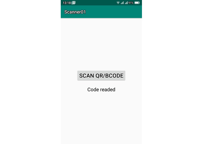
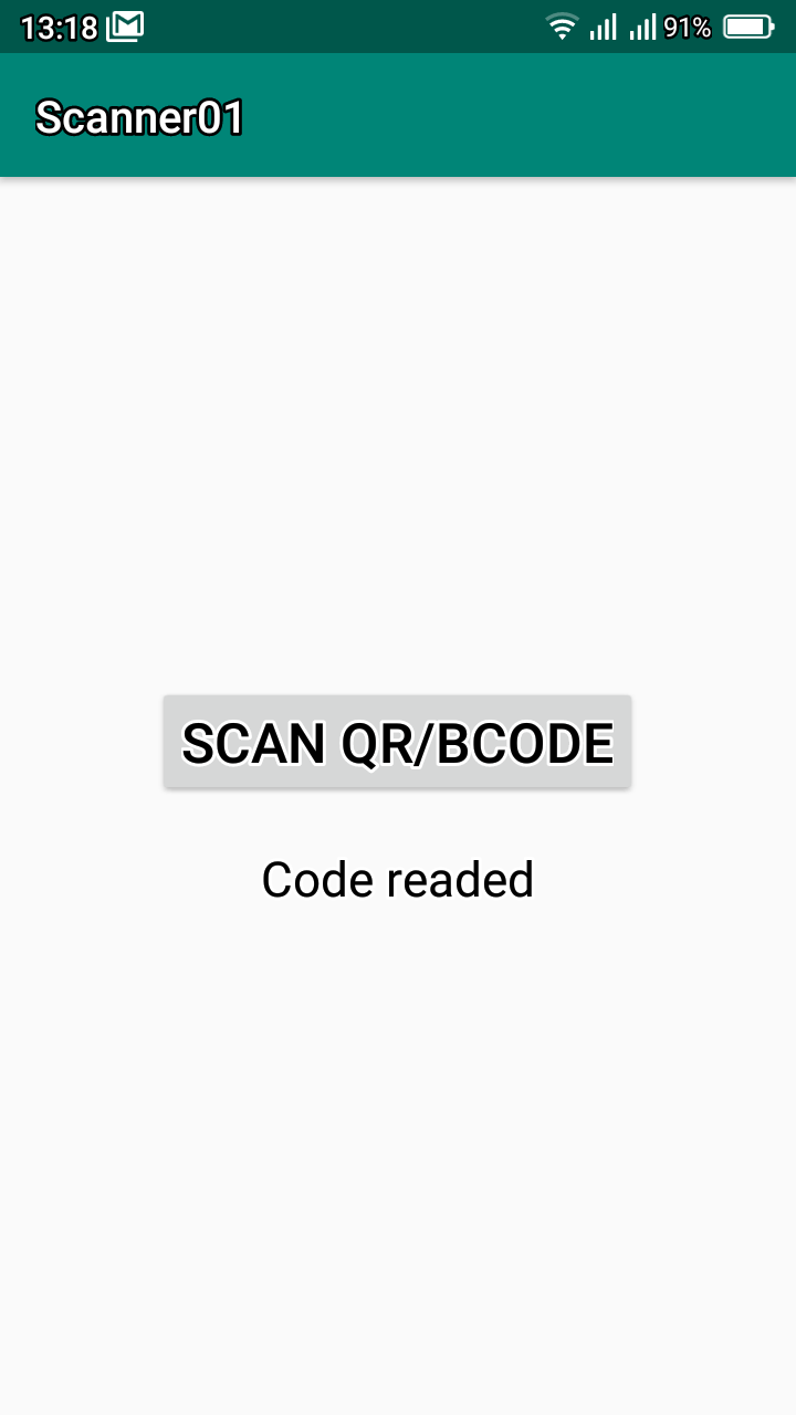
1.- Make baseline app to take recognize QR codes:
........ QR detected and readed. Window working reliability poor to industrial and logistic market appliance(12/2019)
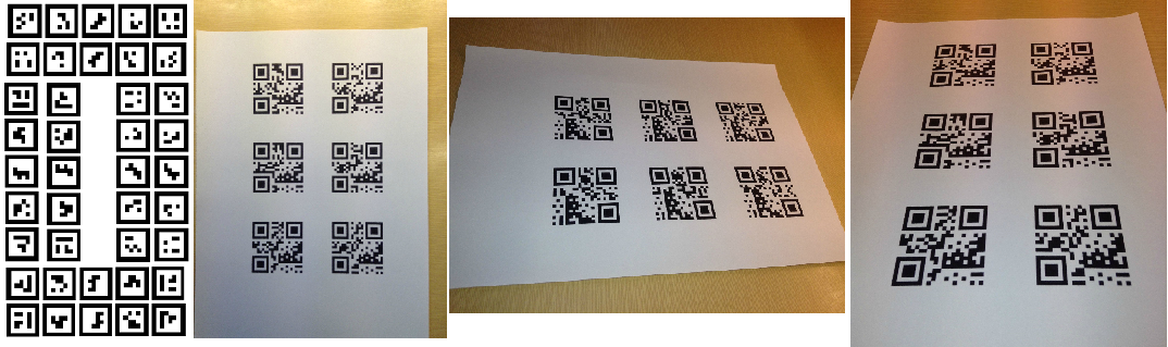
........ Just tested for 3 sizes ARuCo: Better performance and sizing/measurement. Testing now(08/01/2019)
2.- Add feature to save snapshot with ARuCo reference to interest area(optional), steering and positioning, assisted, (pending)..
3.- Add feature to save additional parameters view that contains a set of snapshots.(pending).
4.- Import/export parameters from/to a view to feed a help system to position the camera in next view snapshots (pending)
5.- Save this structured info on mobile device until can be uploaded to cloud, were some stakeholders can review or process view snapshots interest areas collaboratively and safely.(pending)
Challenges we ran into
Best Digital Utility App
Connected Industry Applications
Accomplishments that we're proud of
Next accomplishment is mockup demo on 17th January. Mockup would present:
1.- a set of snapshots for one view, with a assigned marker on visible snapshot, and IR contour for camera model (would be nice).
2.- The assisted graphical dynamics after first snapshot to positioning same model of camera (would be nice).
3.- The structured process to save several snapshots on same view (would be nice).
4.- Optionally, the first snapshot and automatic creation of parameters for positioning camera in next snapshots, referenced to marker(likely).
- - Optionally the process to associate/adapt new camera to continue taking snapshots of the same view in the future (unlikely)


Log in or sign up for Devpost to join the conversation.