-
Demo
Description
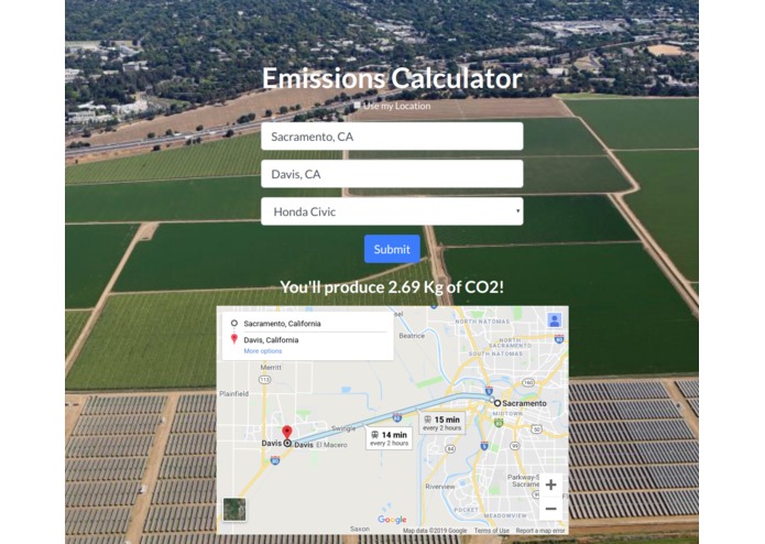
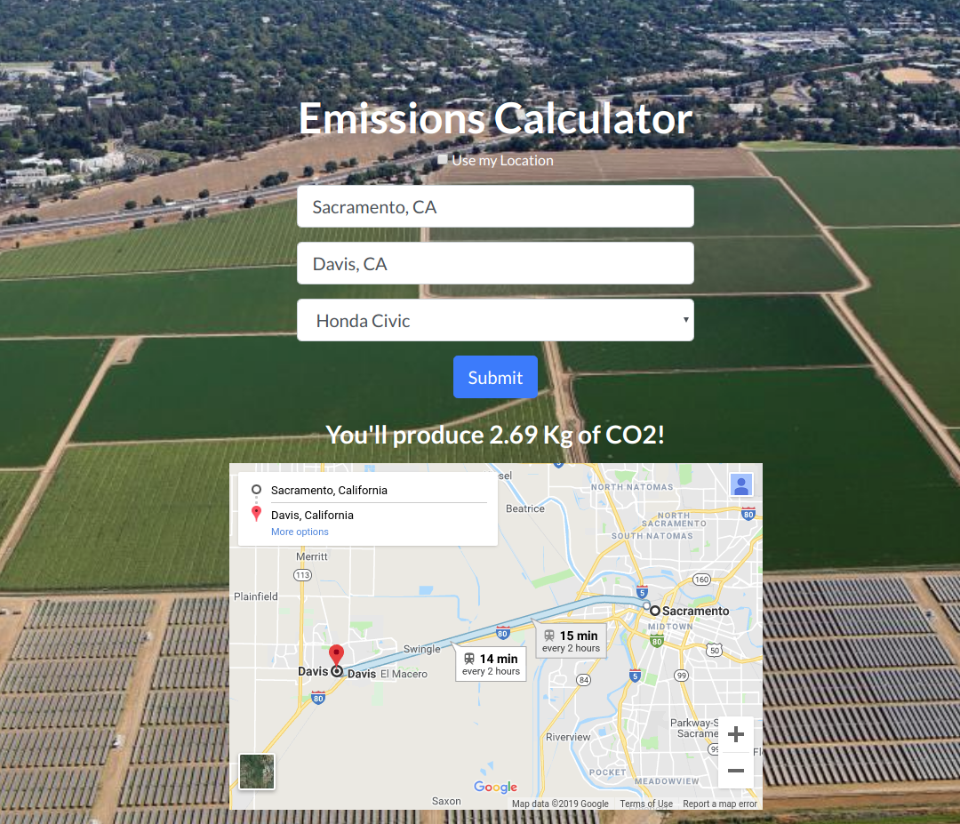
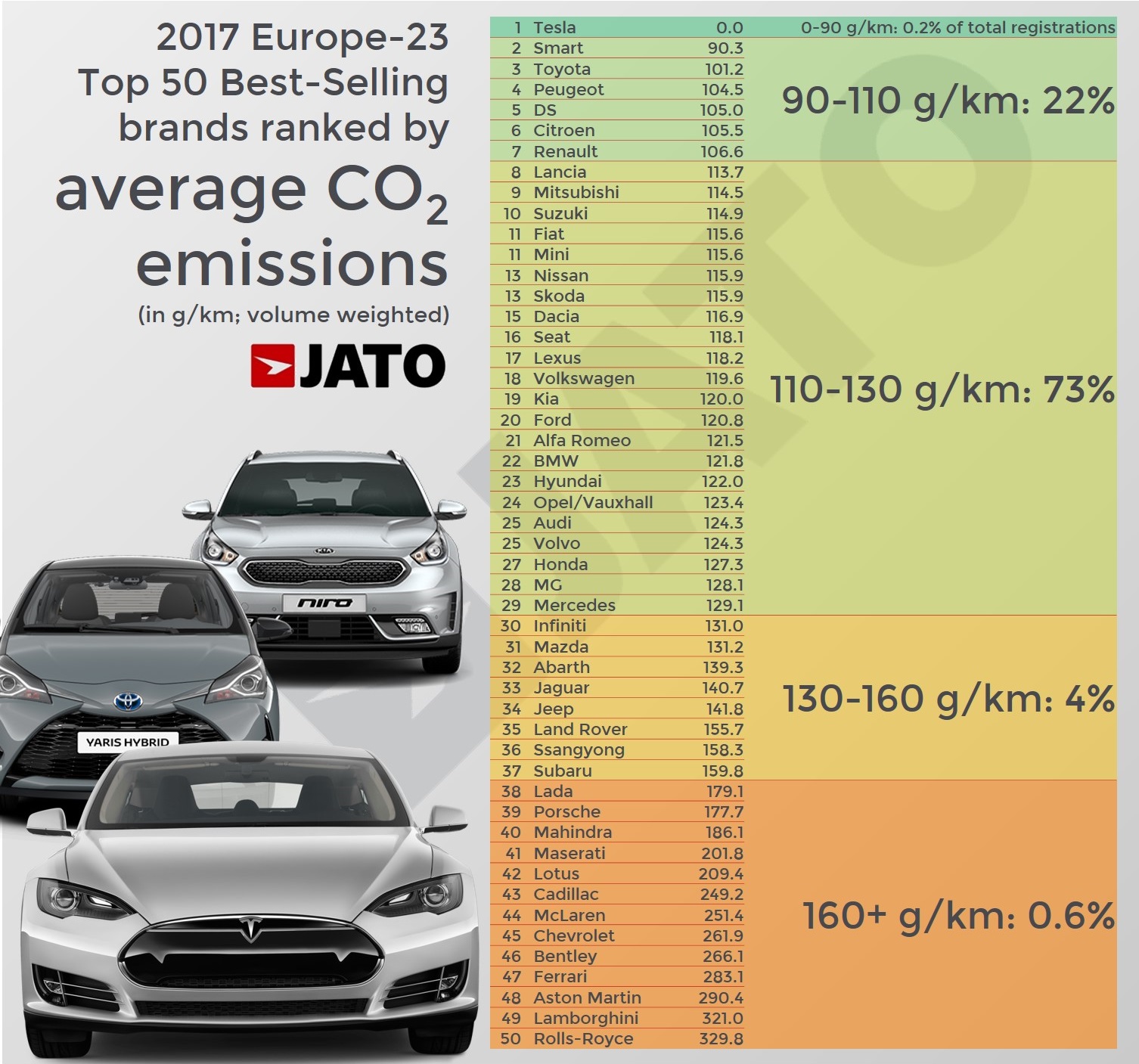
A calculator that uses Google Maps API and geolocation to find the amount of CO2 emissions produced when traveling to a location. The emissions are based on "https://www.jato.com/wp-content/uploads/2018/04/18.jpg" which is then stored into a Google Firebase database.
Objective
To gain a better understanding of API integrations and Databases through the theme of the betterment of the environment.
Domain
The domain that this application is registered to is "www.whatsmydamageon.net"
How it Works
A user first enters a location for the source, or starting location, then a location for the desired destination, and finally a corresponding car manufacturer to their vehicle. Then a calculation is performed to determine the amount of CO2 emissions the user will emit while traveling to their destination.


Log in or sign up for Devpost to join the conversation.