-

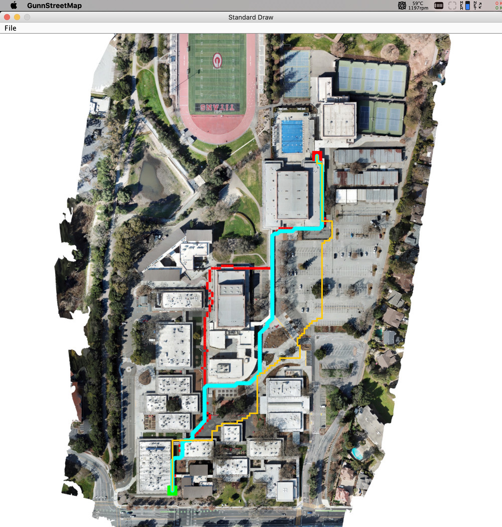
GunnStreetMap finds three different routes between room J10 and the pool.
An interactive map that finds the shortest routes between two classroom at Gunn High School
Inspiration
I remember struggling to find my classes on the map of Gunn, therefore I wanted to help my younger brother find his classes faster next year.
What it does
Helps freshmen, parents, and visitors navigate a new campus.
How I built it
A grid is overlayed onto the map, and all the buildings are set as obstacles, then an A* algorithm finds the best path between them.
Challenges I ran into
How to generate the collision matrix because it is an irregular pattern. - So, so, so many random bugs
Accomplishments that I'm proud of
Writing a method that allowed us to draw the "hitboxes" of the buildings, then save the matrix to a text file which could be referenced in the future.
What I learned
Writing pathfinding algorithms is harder than it looks - Practiced writing Java
What's next for GunnStreetMap
Add different map backgrounds and a GUI to switch between them - Have it avoid congested areas of Gunn, eventually with locations from its users - Turn it into a mobile app

Log in or sign up for Devpost to join the conversation.