-
Logo
-
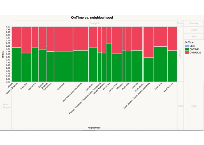
One time/overdue
-
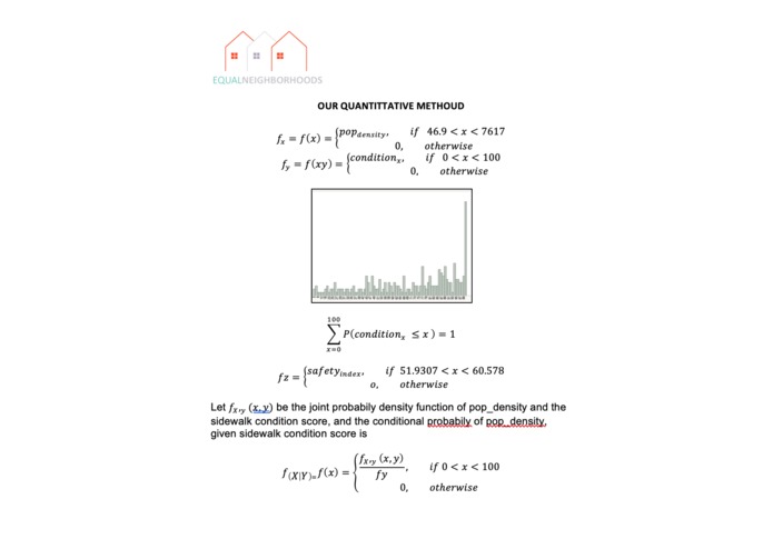
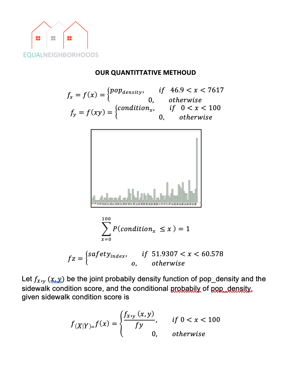
method 1
-
method 2
-
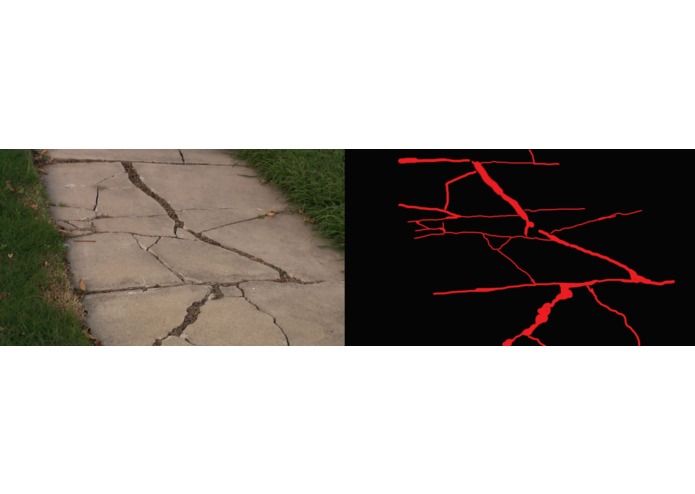
machine learning example


Inspiration
In the city of Boston, many BOS:311 citizen-generated complaints about streets, sidewalks, trash and graffiti mainly come from the neighborhoods that already have sidewalks in good condition. By using those calls to prioritize sidewalk repairs and clean up, the City was further exacerbating inequity. We built our platform designed to prioritize damaged sidewalks based off of road safety, severity of damage, and population density which is often more prevalent in lower income neighborhoods. By making streets safer in places where it matters most, people can lead safer and more secure lives.
What it does
Our web app allows citizens to conveniently submit sidewalk maintenance request forms. Our machine learning algorithm calculates sidewalk conditions based on how much damage is present in the photo that the user submits. Our app then updates the current request priority list based off of the location of the maintenance request, sidewalk condition, and safety rating. In addition, the app plots a data point corresponding to the location of the request on a Google Map located in our Information Tab.
Challenges we ran into
Due to time and hardware constraints, the outcome was not what we expected. In addition, we had limited data that led to limited training Given more time and more powerful computing power, we are confident the results will be more promising.
Accomplishments that we're proud of
We created a platform that classifies sidewalk damages based on varying severity in the streets of Boston and prioritizes which maintenance reports to address first. We successfully implemented the Shine API by utilizing its total home score dataset to target damaged sidewalks near low road safety scores and prioritize their maintenance. Our web app allows pedestrians to safely walk on proper sidewalks which reduces the likelihood of road injuries, thus leading safer, more secure lives. We are also able to create a visual map of the severity of each sidewalk. We also create a map that depicts all the unresolved cases that can be added into the geographic map.
What we learned
- Learned how to use different API’s like Liberty Mutual’s Shine API.
- Learned about simple machine learning algorithms and the general idea behind it.
- Gained more experience with preliminary image processing.
What's next for Equal Neighborhoods
Our next step of improving our project is to implement machine learning into our data analysis. Using machine learning, we will be able to analyze the severity of the damage of the sidewalks and determine which sidewalk to prioritize. We should also focus on improving our algorithm in determining which sidewalk to prioritize. We should put different weight on each variable instead of prioritizing one variable over another.
Built With
- css
- google-maps
- html
- javascript
- jmp-pro-13
- photoshop
- rstudio
- shine-api
- stata


Log in or sign up for Devpost to join the conversation.